WarDriving…How to Map Wi-Fi Access Points in your City!
In this article I will show you how to easily create an interactive Google map that will show all Wi-Fi access points located in your area. This is also known as “WarDriving“.

With very little hardware, you will be able to create an interactive Google Map that will display the following:
Access Point Names, MAC address’, Signal Strength, Encryption Type of the Access Points, and whether the connection is OPEN or Password Protected for each Access Point discovered. It will also give you the location plotted on the map of where the access point is located from the road. (each plot on the map will be an Access Point, and will show the information for that AP!).
You will need the following hardware and software:
1. Windows XP Laptop or Tablet that is compatible with Netstumbler

You will need to make sure that your Windows XP machine has a compatible Wi-Fi Driver to use the software. This may work with Windows 7, but I’ve never been able to get it to work correctly, so I use an old Windows XP laptop. They are cheap, and will do exactly what you want! If your XP Laptop does not have a compatible Wi-Fi card, you can use an External Wi-Fi Adapter.
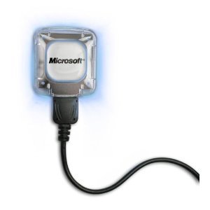
2. USB GPS Receiver (I used the Microsoft Pharos GPS-360 that came with an older copy of Microsoft Streets & Trips…receiver must be XP compatible)
3.NetStumbler <— You can download here it’s FREE!

Step 1
Plug in your USB GPS Receiver and open Netstumbler. ( I generally do not start the Netstumbler program until I am near where I would like to map.)
Step 2
Drive around the area that you would like to map. While you are driving around, Netstumbler is recording the location and information of all of the wireless access points that it discovers.
Step 3
When finished in the area you want to map, Save your Netstumbler .NS1 file! I would recommend saving the file to a directory you can easily remember.
Step 4
From a computer with an active internet connection, navigate to GPSVisualizer.com, upload your .NS1 file and the website will convert it to KML/KMZ format. With this you will be able to see all of your recorded Access Points on an interactive Google Map!


I’m a d-bag comment spammer my IP is 190.73.35.4
WarDriving…How to Map Wi-Fi Access Points in your City! Great post, I was able to follow your simple instructions and map my neighborhood! Mucho Gracias!
Thanks for the marvelous posting! I quite enjoyed reading it, you are
a great author.I will be sure to bookmark your blog and will often come back from now on. I want to
encourage you to definitely continue your great work, have a nice afternoon!
wouldn’t it be easier to use Wigle.net app on an Android tablet or smartphone? Samsung’s Nexus 7 and most smartphones already have a GPS receiver built-in. Just saying.
There are many ways to do it, Was just posting one way 🙂